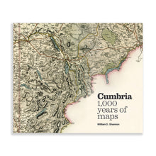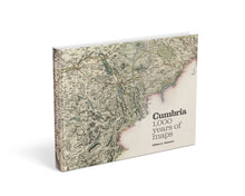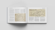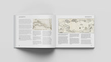
The name Camri first appears on maps in AD1050. Since then the Lake District and historic counties of Cumberland, Westmorland and Lancashire have been mapped countless times.
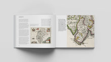
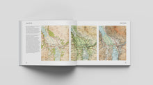
Cumbria – 1,000 years of maps features more than 100 charts, surveys and maps from ten centuries of cartography, including:
- the earliest maps – when the world fitted onto a single sheet of A4,
- the first ‘county surveys’ – elaborate in detail, destined for gentry parlours,
- tourist maps – from Thomas West’s viewing stations to Alfred Wainwright’s ‘love letters to the fells’,
- historical maps – illustrative trips to the wad mines of Borrowdale and the first attempts to map Roman Britain,
- travel maps – recording the golden ages of canal, rail and road,
- maps of the Ordnance Survey – and the evolution of a military department into the best map-maker of its time.
From geological plots to nautical charts, audacious forgeries to postal itineraries, town surveys to military plans, Cumbria – 1,000 years of maps not only profiles the evolution of Cumbrian cartography, it also celebrates the rich social history of a much-loved landscape.
- For a sample chapter featuring Map #56: 'Plan of Line of Aqueduct from Thirlmere to Manchester', Manchester Corporation Water Works, see https://hefted.substack.com/p/maps-of-cumbria-56-plan-of-line-of
- For sample chapter featuring Map #59: ‘Official Railway Map of the Cumberland & Westmorland Districts, prepared and published by The Railway Clearing House, London’, see https://hefted.substack.com/p/hefted-newsletter-2-august-2024
- For an article by William picking six of his favourite maps from the book, see https://hefted.substack.com/p/six-iconic-maps-of-cumbria
Reviews
"William's fascinating survey sweeps from the first map to mention Cumbria... to a modern map with a much deeper historical frame of reference... The danger with picking this book up is that further epochs will pass whilst you read." Cumbria Life
"One cannot fail to be immediately impressed by the visual impact of this volume. The publishers, Inspired by Lakeland, are gaining a reputation for sumptuous publications, and the quality of production is excellent... For anyone interested in either maps or Cumbria (or both) this is a not-to-be missed volume and is thoroughly recommended." British Association for Local History (full review at https://www.balh.org.uk/publication-review-november-2024-reviews)
"There is something here from glaciers to railways, from Hadrian and his Wall to Wainwright and his walks, and along the way many informative comments, not least that the concept of a flat earth was a Victorian myth. The book is beautifully produced at a very attractive price with the text reflecting a lifetime's study of the subject." David Breeze FSA, Society of Antiquaries Newsletter.
About the author
William D. Shannon specialises in aspects of landscape and agricultural history, with a particular passion for maps and their history. He is a vice president of the Cumberland and Westmorland Antiquarian and Archaeological Society, a trustee of the Cumbria County History Trust,and a Fellow of the Society of Antiquaries. Previous books include: Seventeenth-Century Lancashire Restored and Murus Ille Famosus, about the depiction of Hadrian’s Wall on early maps. William’s PhD was on the reclamation of lowland mosses in the north-west, and he has contributed to more than 40 academic papers.
Details
-
PAGES: 256+4 cover (260 total)
-
SIZE: 300mm x 250mm (landscape)
-
FORMAT: Hardback - 300+ images.
- ISBN: 978-1-915513-05-2
***Here at Inspired by Lakeland we hate waste. Therefore we are giving away a free Foods of Cumbria tea towel with every £15 spent. These are almost perfect tea towels… with just a tiny spelling mistake (bet you won't spot it!). We can’t sell them, but we hope our lovely customers might like them as a free gift. (Whilst stocks last, and only added if it fits in the pack and doesn't incur additional postage costs!)***


